
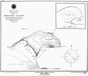
Avadlek Spit
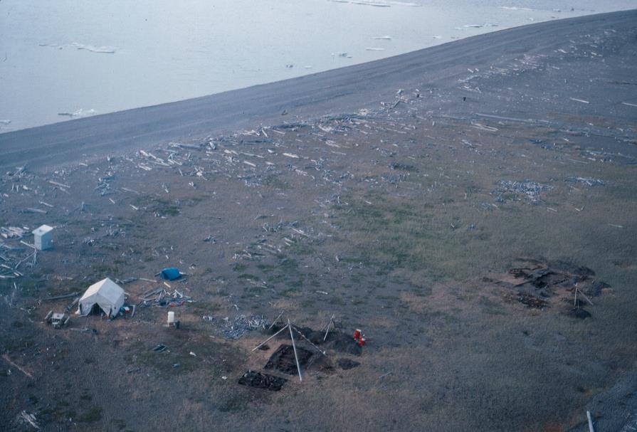
Avadlek Spit is one of three gravel spits on Qikiqtaruk, which are all remnants of the coast before the island was separated from the mainland [1]. Some of the earliest evidence of human occupation, known from two excavated Inuvialuit houses, are located on Avadlek Spit. These are now under threat from coastal erosion which is being monitored through a multi-year project with drone photogrammetry.
Region:
Yukon
Field Documentation:
June 27, 2022
Field Documentation Type:
Photogrammetry
Historic Period:
1500CE
Latitude:
69.552687
Longitude:
-139.315313
Threat Level
Avadlek Spit
The name of Avadlek Spit comes from the Inuvialuktun word avalliq, meaning furthest away [1]. The spit is located at the west end of Workboat Passage opposite the Firth River on the mainland and is close to 5 km long [1]. The low lying nature of the spit and proximity to the coast mean that inundation and the removal of sands and gravels change the environment constantly [1]. The vegetation has adapted to the exposure of salt water, bearded seals are often seen hauled out during the spring and summer, and it is also known to be a good fishing spot [1]. The exposed shore is often covered with driftwood bought down by the Mackenzie River [1].
Inuvialuit History

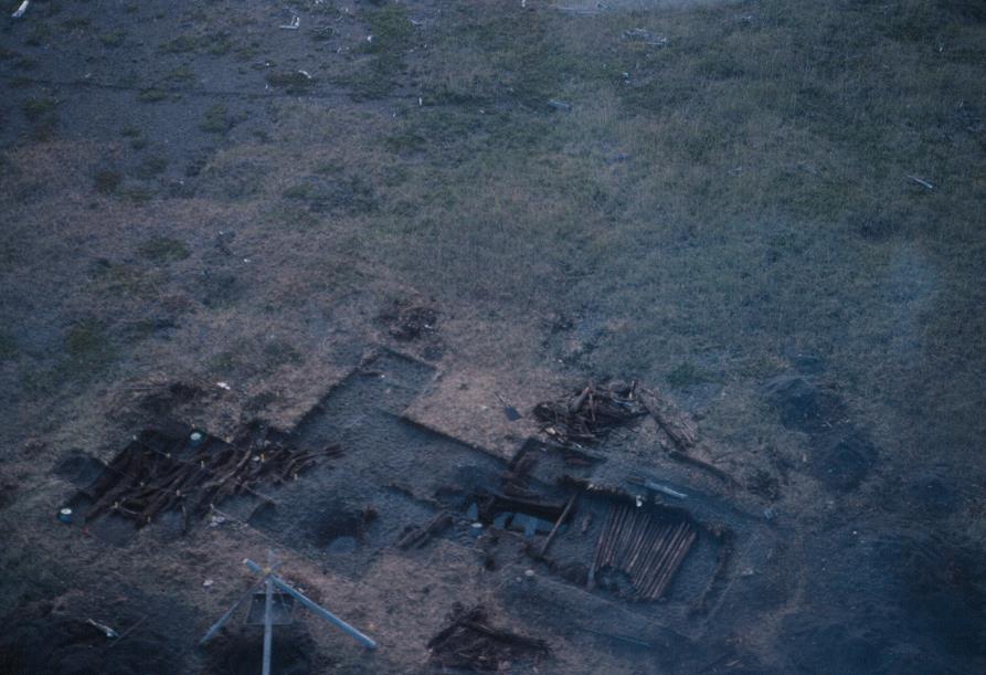
The Inuvialuit occupation at Avadlek Spit dates from around 1500 AD and is a small and unusual settlement [1], which was excavated in 1991 as part of the Qikiqtaruk Archaeology Project [2]. The site consists of two well preserved sod houses, associated middens, two caches, and a possible rack used for drying meat [1, 2]. The two houses were rectangular in shape, not the typical crucifix formation of sod houses in this region, with only the rear sleeping platforms present [1, 2]. Another feature often associated with sod houses are entrance tunnels, however only one of the houses had evidence of an entrance tunnel [2]. A variety of faunal remains were found within the houses and middens of fish, brids, caribou, whale (beluga and bowhead), bear, and fox, which are largely associated with the warmer summer months [2]. Unusually, for this region seal remains were almost completely absent from the faunal collection [2].
The site at Avadelk Spit was a small community with one or two houses that was seasonally occupied by single family groups [1]. This is a very different pattern of occupation that is seen on the other side of the island at Washout and Pauline Cove. At these locations more houses have been identified that are larger in size. It is thought that between four to six houses were occupied at any one time, with up to 30 to 50 people living in them [1]. Washout is the earliest occupation, between 1200 AD and 1600 AD, and largely relied on ringed seal which was hunted during the winter [1]. The Inuvialuit migrated westward along the coast to Pauline Cove, until European arrivals, where they still relied on seals with a significant increase in fish [1].
Euro-North American History
The importance of Avadlek Spit to the Inuvialuit is clear with nearly 500 years of occupation seen through the archaeological remains, the documentation by Euro-North American Arctic explores, and the modern artefacts of hunting found during the excavations in 1991 [1, 2].
Current Conditions
The effects of climate change have been impacting all areas of the island to varying degrees. At Avadlek Spit the impacts of climate change have not been as apparent, but the increase in the number of storms and their intensity have started to erode the spit as vegetation is lost and the gravels move and relocate. With less vegetation and ever changing shore line (see the before and after slider) the archaeological remains are in constant danger of being lost forever.
Monitoring
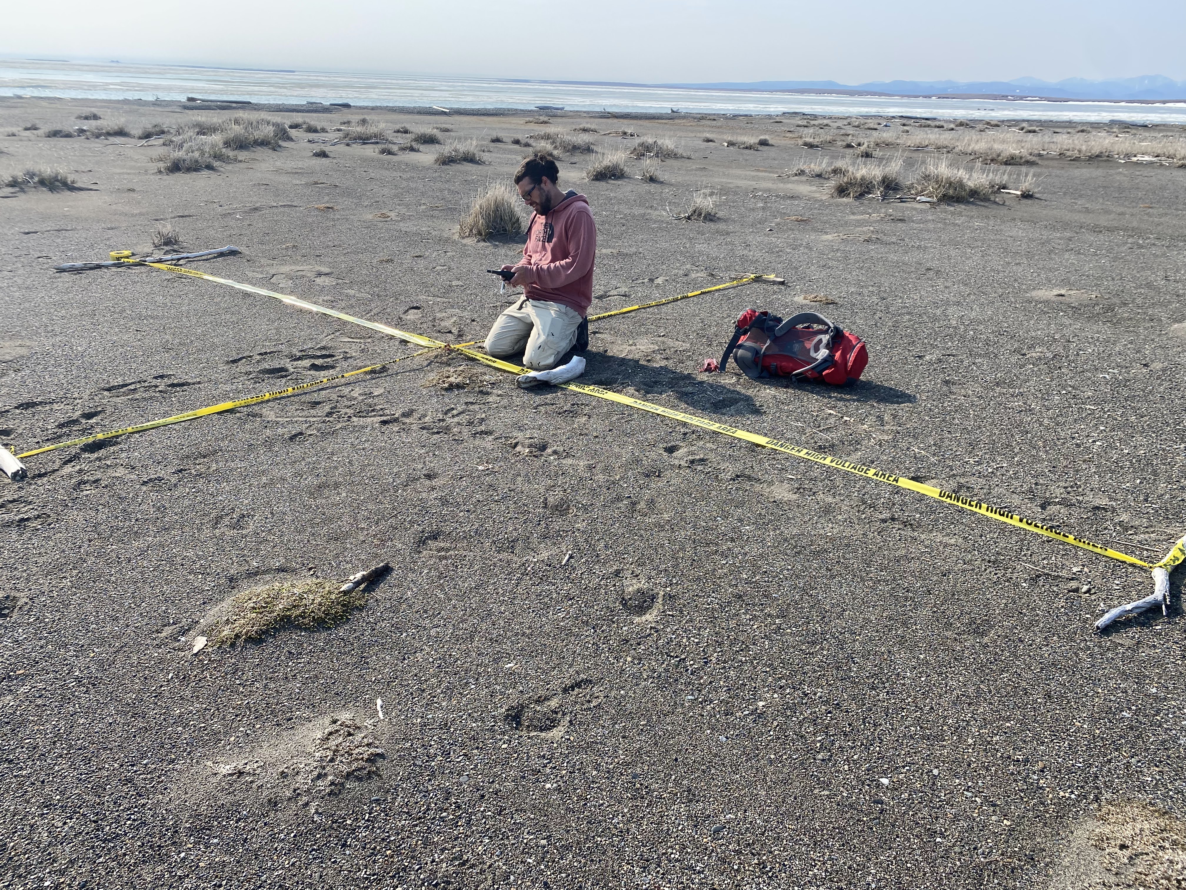
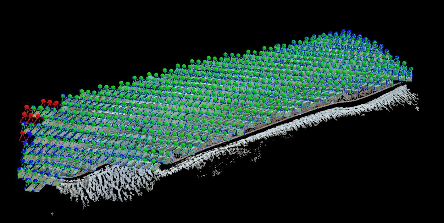
To determine the rate at which Avadlek Spit is changing and the implications for the archaeological remains a monitoring programme was initiated in the summer of 2022 with the first dataset collected by the Capture2Preserv Team and the Yukon Government. With the success of a UAV monitoring programme implemented at Simpson Point in 2019, the methods and techniques for the Avadlek Spit will be based on the lessons learned at Simpson Point. For the data capture methods and techniques see the data capture section.
Notes
[1] Burn, Christopher R. (editor). 2012. Herschel Island Qikiqtaruk: a Natural and Cultural History of Yukon’s Arctic Island. Library and Archives Canada Cataloguing in Publication, Calgary.
[2] Friesen, T. Max. 1992. Qikiqtaruk 1991: Archaeological Investigations on Herschel Island, Yukon Territory. On file at Yukon Heritage.
[3] McCoy, Roger M., 2012. ‘Peter Dease and Thomas Simpson Extend the North Coast Map, 1837‘, in On the Edge: Mapping North America’s Coasts (New York, 2012; online edn, Oxford Academic, 16 Mar. 2015), accessed 27 Oct. 2022, https://doi.org/10.1093/acprof:osobl/9780199744046.003.0015
[4] William R. Sampson, 2003 “DEASE, PETER WARREN,” in Dictionary of Canadian Biography , vol. 9, University of Toronto/Université Laval, accessed October 27, 2022, http://www.biographi.ca/en/bio/dease_peter_warren_9E.html
In this gallery images by Murielle Nagy have been sourced from the Inuvialuit Digital Library. The rest of the images have been captured by the Capture2Preserv Team.


The raw data files for this project are available for download from the archive repository. There are two data sets created from the UAV photogrammetry. The point cloud data is in .las file format. The orthomosaic image are in World Tiff file format (.tiff, .wtf, .prj). Please download the metadata template to access metadata associated with each file. All data is published under the Attribution-Non-Commercial Creatives Common License CC BY-NC 4.0 and we would ask that you acknowledge this repository in any research that results from the use of these data sets. The point cloud data can be viewed and manipulated in CloudCompare an opensource software.
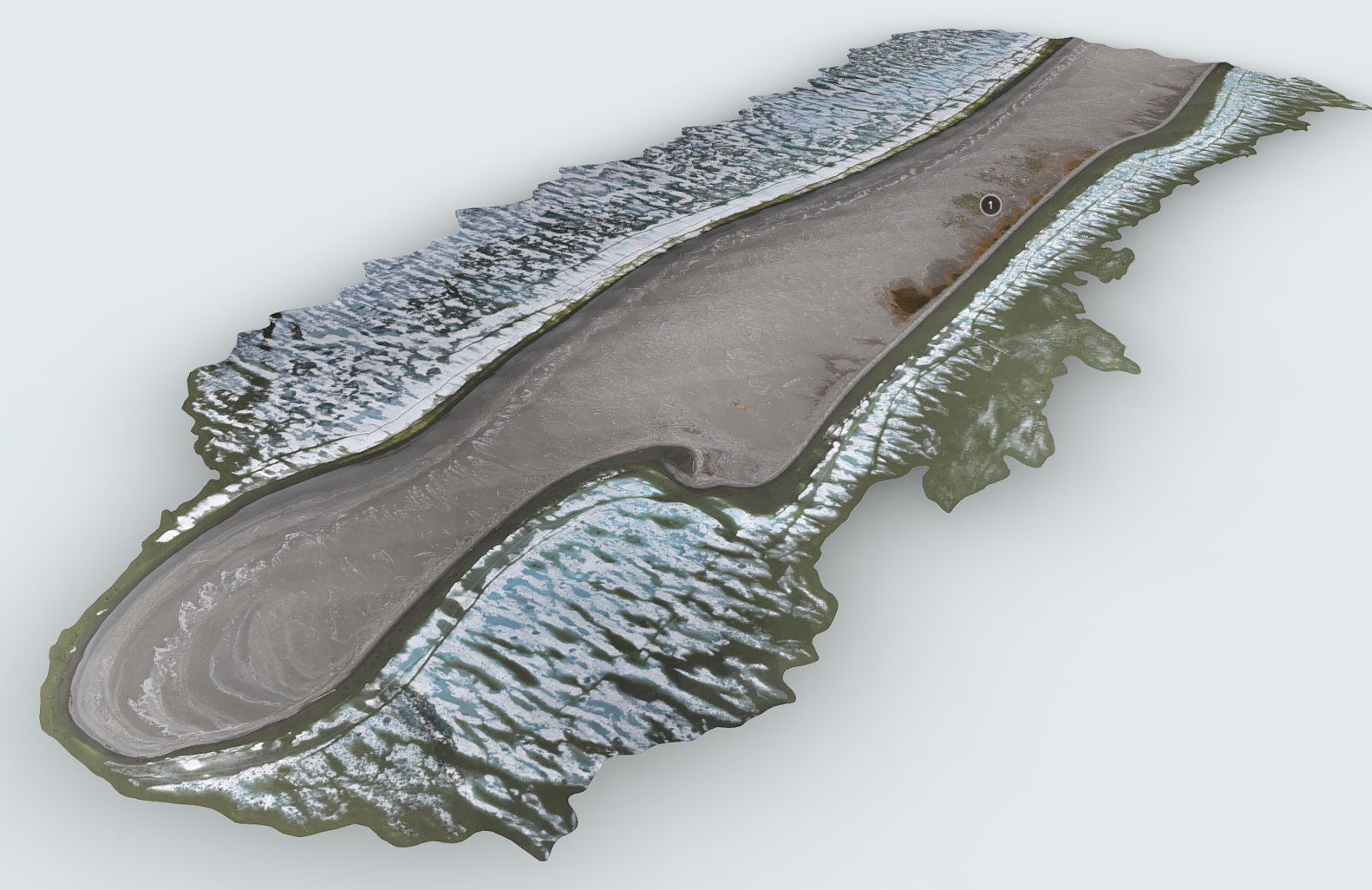
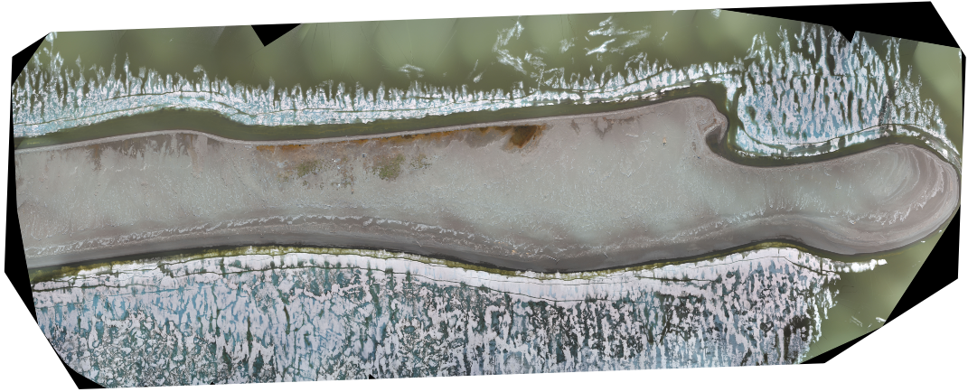
Avadlek Spit was captured using a Sensefly Ebee Geo Fixed Wing Drone. A series of targets were first established at various locations on the spit. A pre-planned mission to capture areas of the spit that contain cultural features was then flown using Sensefly’s eMotion software. The data was then processed using Pix4D mapper. The resulting photo orthomosaic and 3D point cloud of the spit will serve as baseline information for a planned multi-year UAV monitoring program. Additional flights in future years will be compared to this baseline map to identify and track changes to Avadlek Spit and its many heritage resources.

Photogrammetry Data
Grab the Slider With Your Mouse and Move it Left and Right to Compare Images.
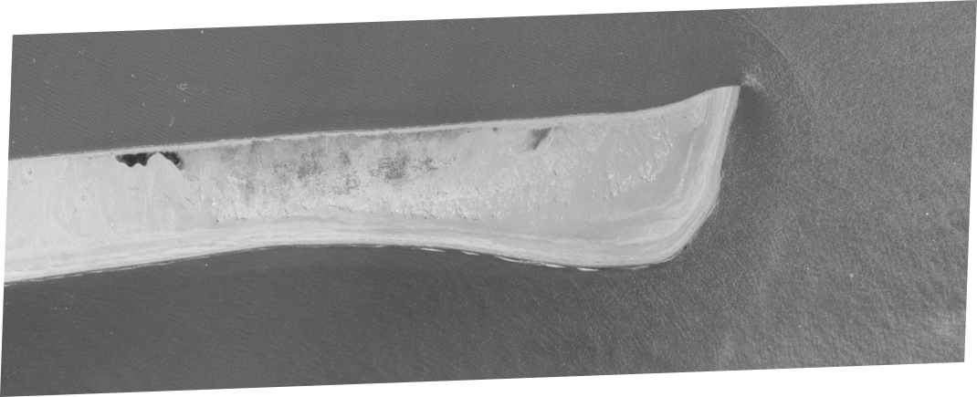
Aerial Photo 1970 and UAV Data 2022